![]()
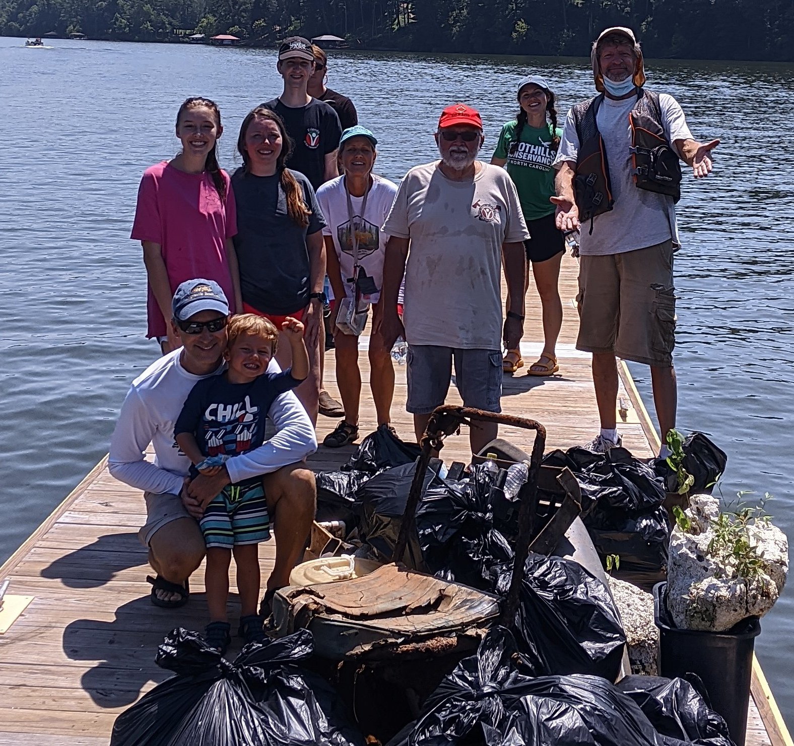
An RTP grant provided funding for signage at access points along the Upper Catawba River Paddle Trail. There is not an agency in charge of the trail, checking the conditions or promoting it. Information on this page is from the signs placed at launches. (Design work by DbD)

River Access Points
10 – Watermill Road 35.743771, -81.772441
11 – Morganton Weir 35.738502, -81.732017
12 – Morganton Weir Dam Portage 35.739871, -81.729688
13 – Greenlee Ford 35.740853, -81.717968
14 – River Village 35.747091, -81.706037
15 – Rocky Ford 35.772230, -81.691189
16 – John’s River (Spur) 35.793163, -81.676864
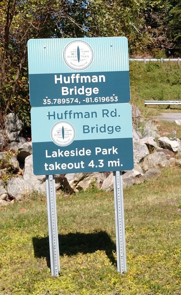
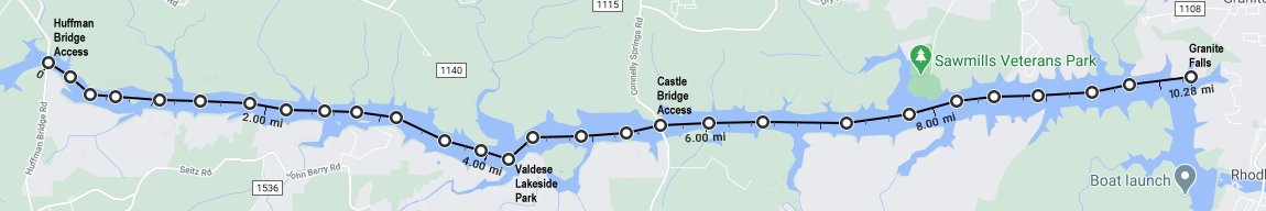
17 – Huffman Bridge 35.789574, -81.619653
18 – Valdese Lakeside Park 35.774120, -81.546513
19 – Castle Bridge 35.781818, -81.524949
20 – Connelly Creek 35.784041, -81.484686
21 – Lakeside Park in Granite Falls 35.786480, -81.440664
22 – Rhodhiss 35.771500, -81.442400
23 – Rhodhiss Portage 35.771300, -81.438000
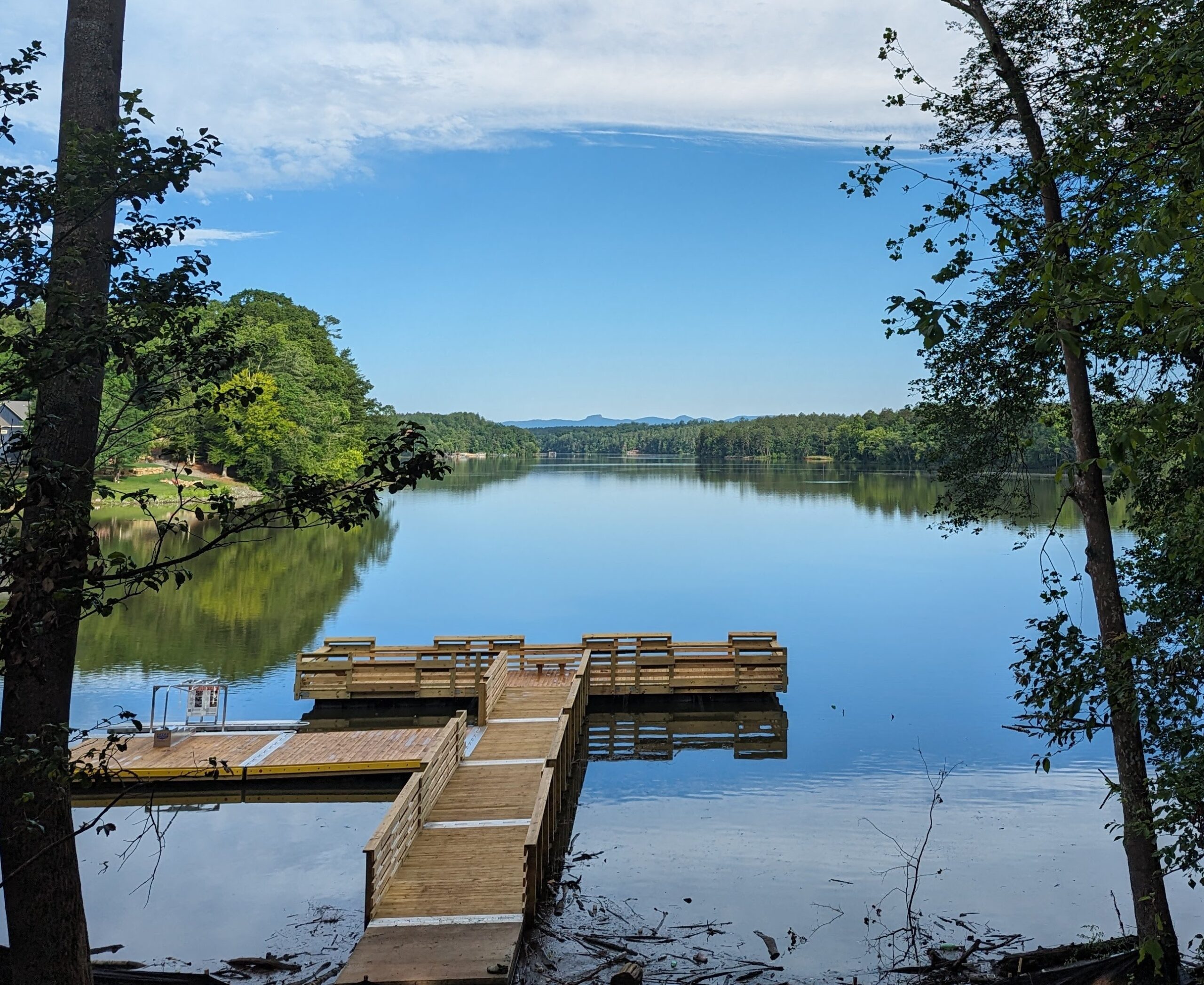 Valdese Lakeside Park Access is #18 on the map and the ADA launch is shown to the left. This blueway will share access points with the Burke River Trail (hiking).
In addition to the large info/map sign, each site has GPS coordinates that can be seen from the water with distance to next launch.
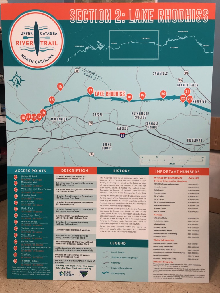
History of the Catawba River – The river is named after the Catawba Indians – “the people of the river.” Running for 220 miles, it starts in McDowell County and ends in SC as the Wateree River. Duke Energy is responsible for managing the reservoirs and regulating development on the river.